RETURN TO TK and GMAN WEBSITE

Monday, June 22, 2015

Cascade Locks, Oregon

The next step of our pacific northwest adventure led us to the heart of the Columbia River Gorge,  Cascade Locks, OR.  When we arrived EARLY at our hotel, the Best Western Plus Columbia River Inn, our room was not yet ready. The nice people at the front desk allowed us to change out of our clothes still wet from our hike through Oneonta Gorge.

Welcome to Cascade Locks, OR

Best Western in Cascade Locks, OR

View of Columbia River from our hotel window

View of Best Western from across Columbia River

The beautiful town of Cascade Locks sits on the edge of the Columbia River surrounded by the evergreen dotted mountains of the Columbia River Gorge.  After refreshments at Thunder Island Brewing we set off to explore the remnants of the locks at Marine Park.

Relaxing view from the garden at Thunder Island Brewing Co.

You can be a PCT angel and buy a pint for the thru hikers
One of several bronze statues at Marine Park.  This one is of Lewis & Clark's guide, Sacagawea, and a newfoundland dog named Seaman.

SIDE NOTE:  Our visit to Cascade Locks was twofold:  1.  we wanted to investigate the town's rich history, and 2. because TK is totally obsessed with the book, Wild, written by Cheryl Strayed (see below). 

What is left of the locks

More remnants of the locks

The locktender homes are now museums

One of three locktender homes

Prepare to get your history on...

First, you must understand that this small settlement, that grew up on the banks of the Columbia river, helped early travelers portage around the rapids, first by foot, then by mule-drawn rail cars, steam engines, and finally riverboats.

Lewis and Clark’s Corps of Discovery portaged around the rapids of the Cascades in 1805. They wrote in their journal, “this great chute of falls is about 1/2 a mile with the water of this great river compressed within the space of 150 paces…great number of both large and small rocks, water passing with great velocity forming & boiling in a horrible manner, with a fall of about 20 feet” (October 30- November 1, 1805).

1908 Photograph, before Bonneville Dam was built, showing steam engine going through locks

Forty years later pioneers traveling the Oregon Trail’s water route were forced to make the same portage around the dangerous rapids. Travelers heading west had to make a crucial decision just upstream of these rapids at The Dalles, OR.  They had to choose whether they would risk life and limb on Mt. Hood’s steep Barlow Road, and overland toll route, or build a raft and float down the Columbia River, risking their life free of charge.

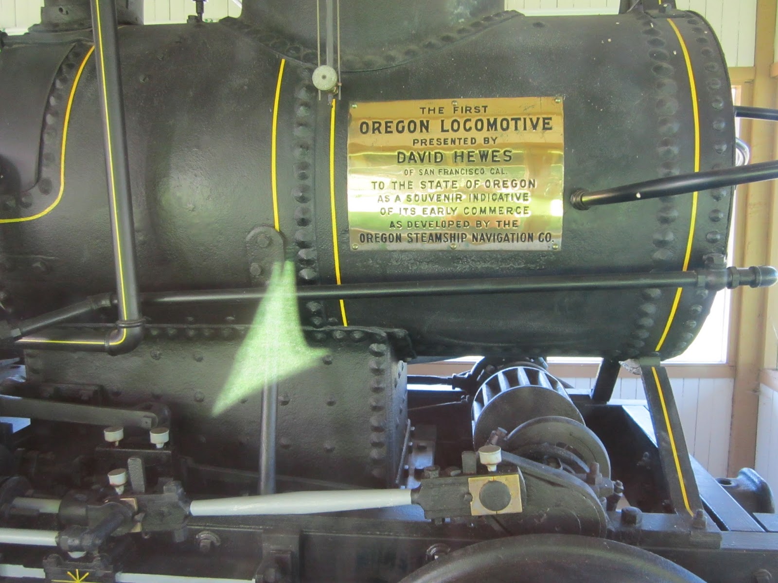
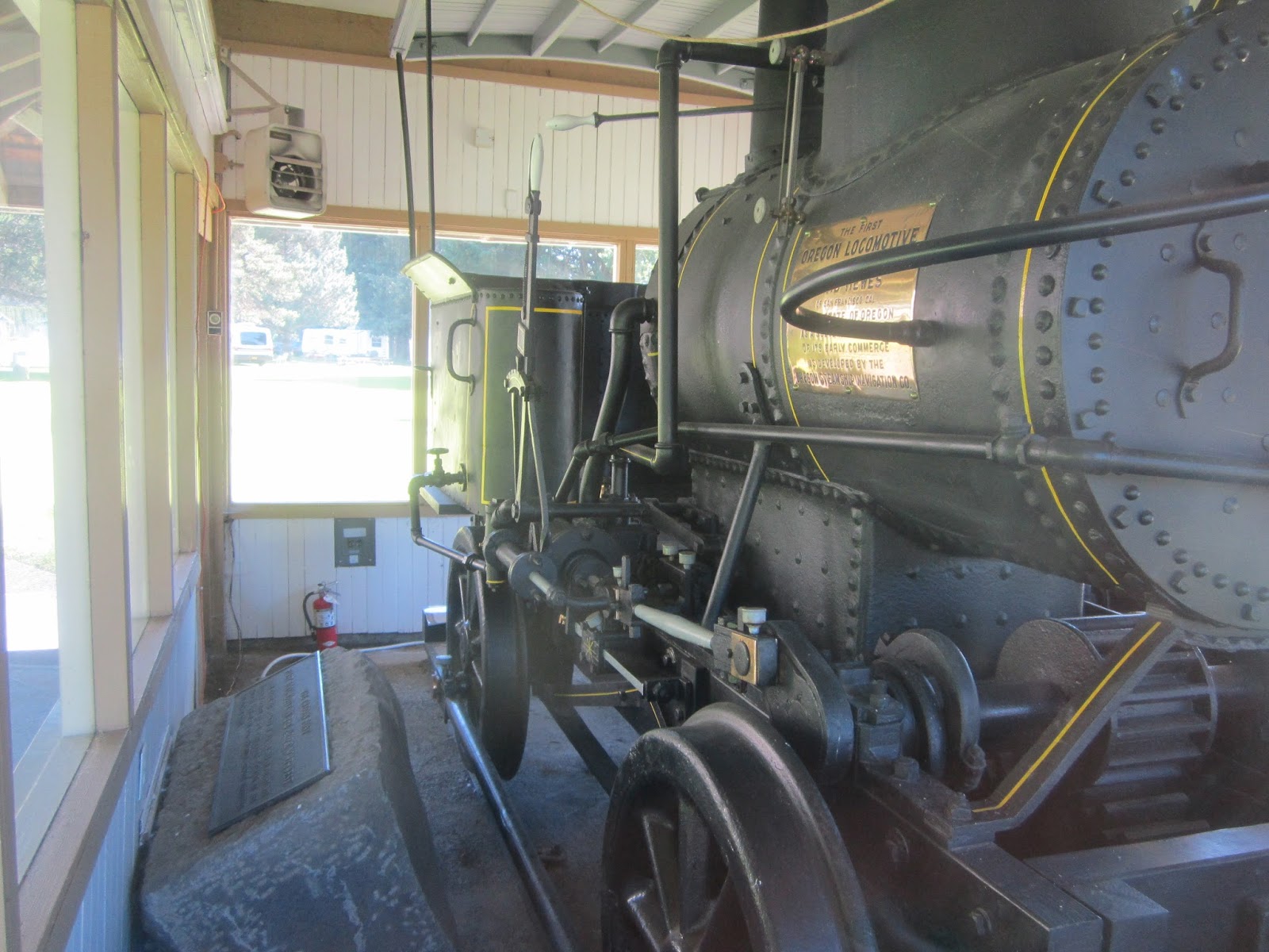
The little Oregon Pony, the first steam engine west of the Mississippi River, carried passengers and freight past the rapids in 1864. Today, the engine can be viewed in Marine Park.


In 1896, the navigational canal and locks at the site of the rapids were completed, and modern-day Cascade Locks was born.

The locks around 1913

The locks allowed safer navigation of the river, and riverboat whistles echoed in the Gorge each day as the boats made their runs from Portland and The Dalles. Passengers still disembarked at Cascade Locks for portage around the rapids until 1938, when Bonneville Dam succeeded in completely taming the rapids.

Columbia River after Bonneville Dam was built


Now, prepare to get your hike on...

Like we mentioned above, Cascade Locks was the town in which Cheryl Strayed ended her solo hike of the Pacific Crest Trail.  She hiked from Mount Hood down into the Columbia River Gorge and into Cascade Locks, stopping at the East Wind Drive-In for an ice cream cone and then crossing Bridge of the Gods before ending her hike and moving to Portland.  This trip would not have been complete without TK retracing Cheryl's steps through Cascade Locks!  So....we started at the East Wind Drive-In for a delicious twist cone.  We sat on a few rocks next to the drive-in enjoying our ice cream and watching the other ice cream eating zombies devour their cones.

Line forms for a twisty cone at the East Wind Drive-in

Next, we checked in to the hotel and prepared our day packs for a hike up the PCT. We found the spot where the PCT starts at Toll House Park and hiked it to the PCT Winter Trailhead.  The forest was dense and dark beyond the trail and the perfect environment for a sasquatch to hide.  Unfortunately the only sasquatch we saw was across the Bridge of the Gods and in the middle of Skamania County, Washington.  Oops, we said too much!  Let's save this story for another blog post.

TK at PCT Trail marker under Highway 84

Hiking the PCT

Hiking the PCT

Bridge of the Gods trailhead marker

Crossing Bridge of the Gods, Washington on the other side

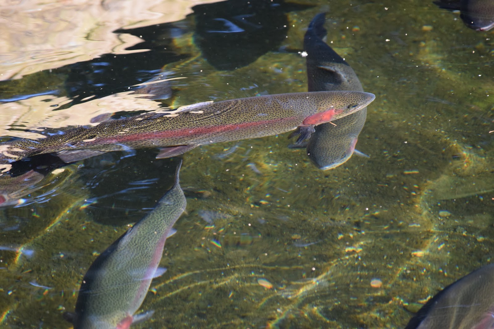
After crossing over Bridge of the Gods and back we drove to Bonneville Damn.  It was closed for the night so we walked along the paths of the Bonneville Fish Hatchery. Everything is beautiful in Oregon - even the fish hatcheries! Beyond the outdoor sturgeon pond there is a small white building that you can walk into. This is the Sturgeon Viewing Center, which was built in 1998.  Herman the Sturgeon is located in the Sturgeon Viewing Center and is approximately 10’ long, 425 pounds and over 60 years old.

Lavender beds at Bonneville Fish Hatchery

Roses at Bonneville Fish Hatchery

Yum...make mine almondine!

Herman the Sturgeon

Tired and hungry we made our way back to Cascade Locks where we enjoyed a pizza (a mainstay in Oregon) and a microbrew at Cascade Locks Ale House.  After feeding our face we called it a night and headed back to the hotel for some rest and relaxation.  The next morning we said goodbye to Cascade Locks but not without stopping for a delicious breakfast, courtesy of the Best Western, at the Char Burger

When we returned home we stumbled upon this short video about Cascade Locks from Grant's Getaways of Travel Oregon.  Check it out!


Columbia River Gorge, Oregon

Day two of our Northern Pacific adventure found us in the Columbia River Gorge.  The Columbia River Gorge National Scenic Area encompasses 292,500 acres, running from the mouth of the Sandy River to the mouth of the Deschutes River and spanning southern Washington and northern Oregon. The Gorge is unique in its natural and cultural history, as well as its designation as a National Scenic Area. 

Beginning our tour in Troutdale, OR

Sandy River
Historic Route 30

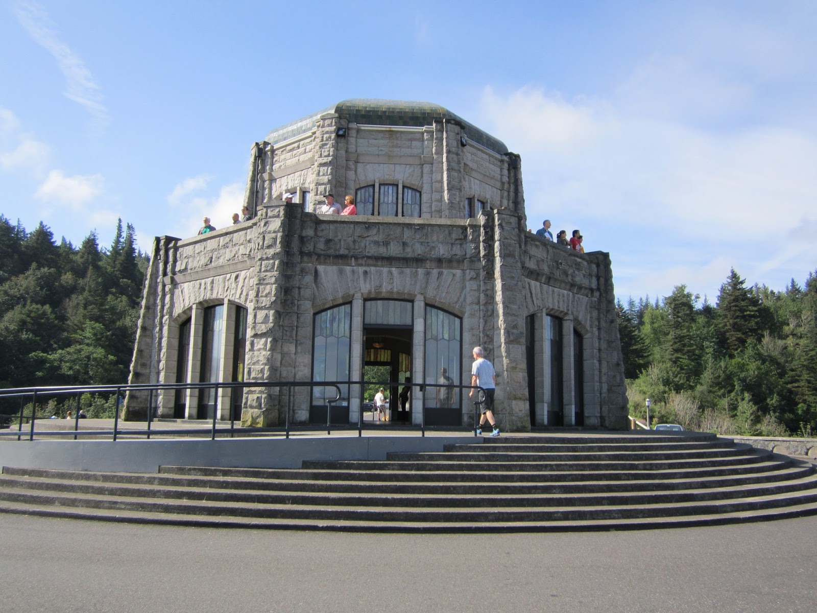
Beginning in Troutdale, OR, we followed the Historic Columbia River Highway stopping at the Women's Forum Overlook and Crown Point Vista House to take in the beautiful scenery.

View from Women's Forum Overlook with Crown Point Vista House middle right
Crown Point Vista House
View from Crown Vista House

Selfie from the parking lot of Crown Point Vista House
Next we hiked to several waterfalls along the gorge with the first one being Latourell Falls.  Latourell Falls is the closest of the Columbia Gorge waterfalls to Portland. It's just barely visible from the highway, but a short jaunt up a steep paved path leads to a clear viewpoint. A walk down a different path leads to the base of the falls. Latourell Falls, a 249' plunge, is beautiful in all seasons.  This is where TK saw her first banana slug.  Watch where you step as these slugs are up to 6" long and make a huge mess if you should step on one!

Latourell Falls
Latourell Falls sign

Yikes!  Banana slug
 The next waterfall we visited was Shepperd's Dale.  In 1915, a local dairy farmer named George Shepperd gave all that he had (this tract of land) to the City of Portland as a memorial to his wife. Today, thousands of visitors along the Historic Columbia River Highway visit this beautiful spot, with its roaring waterfall cascading down steep cliffs into Youngs Creek and out to the Columbia River far below. The upper fall is around 42' tall. The lower tier is around 50' tall.

Shepperd's Dell Falls

 The next waterfall in line was Bridal Veil Falls. The lower trail at Bridal Veil takes you downhill to the base of Bridal Veil Falls and is about a mile round trip to the falls and back. The falls can be fully appreciated from the deck of a viewing platform rebuilt in 1996.

Bridal Veil Falls

After leaving Shepperd's Dale we visited Wahkeena Falls.  Wahkeena Falls is one of the more popular destinations in the gorge and there's a reason for that. Wahkeena Falls has a beauty all its own. It's not a huge, single fall like Multnomah or Latourell and there's no lodge or fancy freeway exit to draw people. Wahkeena Creek falls this way and that, now a plunge, now a horsetail, now a cascade. It's just beautiful.

Selfie in front of Wakeena Falls

Wakeena Falls
Our next stop was Multnomah Falls.  At 621 feet tall, Multnomah Falls is the centerpiece of the waterfall-rich Columbia River Gorge and also the busiest!  By most accounts, it is the tallest falls in Oregon and the most visited natural attraction in the state (did I mention busiest?).   Although Multnomah Falls is suppose to be the climax of a series of large and small cascades all along Multnomah Creek we enjoyed our next stop even more...Oneonta Falls!

Multnomah Falls sign

Lower Multnomah Falls

View of upper Multnomah Falls

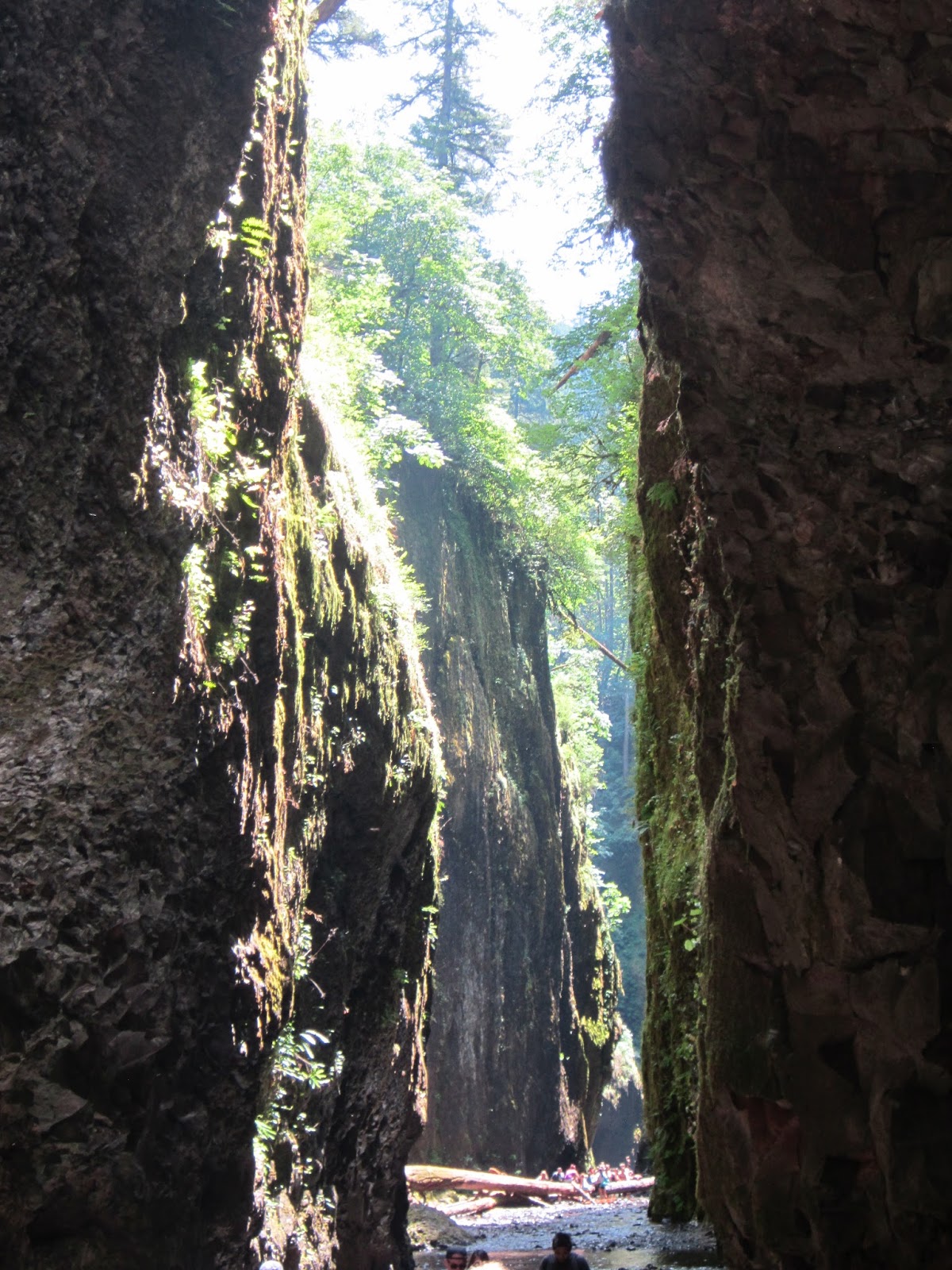
There are four waterfalls on Oneonta Creek.  The lowest falls at the head of Oneonta Gorge, is often called Oneonta Falls, but in fact that is Lower Oneonta Falls.  Lower Oneonta Gorge is not accessible by trail. Rather you must walk up the creek bed, over a large and perhaps unstable log jam, through a moss and fern-lined slot canyon, and up to your waist (or even torso depending on your height and the time of year) in water (icy cold!) until you finally see your prize.   We hiked this trail on a Monday and it was very popular making it slow and difficult to climb the log jam.  When the trail came to the deepest part of the creek it was impossible not to shiver and cry like a baby but, the view of the base of the falls was worth a small amount of discomfort!


Wading through Oneonta Creek to log jam
TK climbing the log jam

Made it past the log jam and looking through slot canyon towards Oneonta Falls

This is nothing.  The water only gets deeper, and colder, from here!

Selfie in Oneonta Gorge

Oneonta Falls, the prize at the end of the canyon

Old tunnel, on older part of the highway 30, now just a walking path
Wet, tired, hungry and thirsty, it was time to say goodbye to the Columbia River Gorge and head into Cascade Locks and find a local micro brewery....oh look, is that Thunder Island Brewing Company I see ahead?


Sunday, June 21, 2015

Portland, Oregon

We had been planning our trip to Oregon for over six months and finally the day came.  We were up at 5:00 AM to catch an early flight to Portland, but almost didn't make it through check-in due to Darius Rucker's band.  They were checking every piece of equipment and instrument known to man!  We finally boarded the plane, starving because we missed breakfast, but had a beautiful window view to make up for it!


Somewhere over New Mexico?
   
After landing it was time to find our ride for the duration of our trip.  Our choices were limited but we went with "cool blue" Beetle that we lovingly referred to as "The Blue Devil."  Surprisingly, this bug was roomy and had some get-up and go!

The Blue Devil!

Next stop was lunch at the Sextant Bar & Galley overlooking the beautiful Columbia River.  After we downed a burger and a pint it was time to explore the city.  We made our way to downtown Portland where we roamed the streets of Portland Saturday Market.


After a few hours of people (tweekers) watching and shopping jet lag hit us hard!  We decided the best medicine was a short pub crawl so we made our way to the Thirsty Lion and then to Kelly's Olympian.


Old motorcycles hang from ceiling


Feeling much better we walked back to our car to find a welcome note from the city of Portland ( a.k.a. parking ticket - we were 6 minutes late returning) but we didn't let that stop the fun.  Next, we headed to St. John's Bridge for a short photography session.


From St. John's Bridge we headed to Council Crest to get a better view of the city.  Council Crest is thought to be the highest point in Portland at 1,073 feet above sea level. From the top of the hill, one can see five mountains in the Cascade Range: Mt Hood, Mt St Helens, Mt Adams, Mt Jefferson, and Mt Rainier.


Next stop was our hotel check-in.  We decided to stay in downtown Portland at the Hilton Portland and Executive Tower.  The room was clean but small and had an awesome view of the streets below.


Dinner that night was going to be at Apizza Shoals located on Hawthorne streets but the wait to get in was too great for weary travelers.  We decided to walk down the street to Hawthorne Fish House for gluten-free (apparently everything in Portland is gluten-free) fish and chips.  The fish and chips were, "eh", but we were so hungry and tired we didn't care.


The next morning we strolled through the downtown area checking out some of the beautiful artwork that adorns the buildings.  Then headed out of town to tour and hike the Columbia River Gorge.  Of course, we had to stop for a Blue Star donut on the way out. 

Blueberry basil & lemon curd

 Goodbye Stump Town!